A doom and gloom warning from tabloid newspapers predicting another Beast from the East this winter may not be strictly correct, according to Ice Watch’s own in-house meteorologist.
And while he’s not ruling out a hard winter, the research on which the predictions are based doesn’t necessarily rule one in either!
Typical fence sitting perhaps? Or maybe just a rather more balanced and scientific approach to a highly complex subject!
Ice Watch is the only winter risk management company to have its own fully qualified in-house meteorologist – in the form of Timo Strom.
And he has analysed the academic paper on which the news story was based to see just how likely it is that the authors’ predictions will come true!
Climate science
The paper, written by three climate physicists at University College London, looks at a number of factors which influence weather patterns and concludes that the combination predicted for the coming months points to the likelihood of a colder winter.
These include looking at the volume of solar activity, or Solar Flux, the change in east-west winds in the stratosphere above the equator, or Quasi-Biennial-Oscillation, and the resultant change in pressure in the North Atlantic.
Their calculations point to what they call a ‘Negative North Atlantic Oscillation’ which increases the likelihood of drier colder conditions.
Jet stream
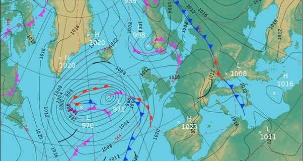
Timo explained: “The North Atlantic Oscillation is the change between pressure in the North Atlantic. In a positive phase there is a strong area of high pressure over the Azores and a strong area of low pressure just off the south coast of Iceland. This means the jet stream is more likely to track over the UK and bring with it milder and wetter conditions. In a negative phase, these areas of pressure are weaker and so there is a higher probability for drier, colder conditions as the jet stream tracks over southern Europe.
“The UCL paper predicts a 71% chance the North Atlantic Oscillation (NAO) will be negative in January and February 2020, which would lead to a higher chance for colder Central England Temperatures (CET). They are predicting a 65% chance that the CET in January and February will be colder than the 1981-2010 average.
Variables
“However, a negative NAO doesn’t always produce a cold winter, it just increases the potential of one. For example, the January to February NAO average in 2004, 2007 and 2011 were all negative, yet produced above average temperatures.
“Also, a positive phase doesn’t necessarily mean there will be mild temperatures. The January to February average NAO index in 2018 was very positive yet there were below average temperatures.”
He added that while the three academics were basing their predictions on two primary predictors – Solar Flux and QBO – many more variables, such as sea surface temperature in the North Atlantic and North Pacific as well as the El Nino-Southern Oscillation (ENSO), can play a part in a winter forecast.
“It is certainly interesting, and I will be interested to see if their theory works,” he added.
Tailored gritting service
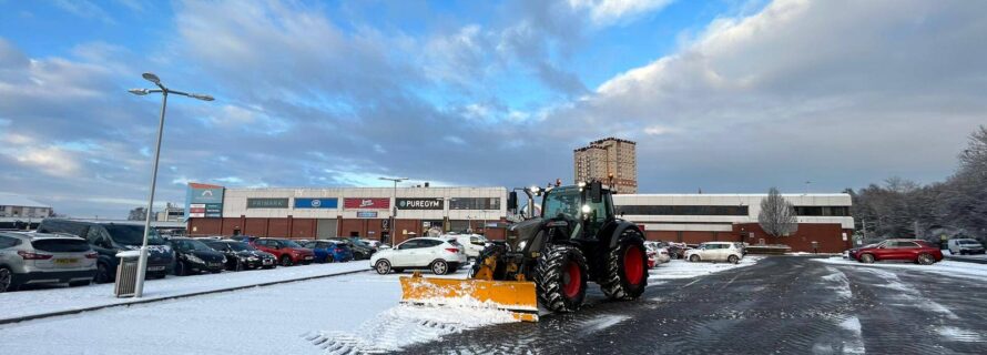
But while the predictions may help (or upset) the public on a personal level, from a professional point of view, advance forecasting needn’t be of a concern. Organisations signed up with Ice Watch will receive a precisely tailored winter gritting service based on real time forecasts.
The snow desk is manned 24/7 during times of predicted snowfall, with the team planning precisely when the gritting teams need to start work to enjoy maximum benefit from the salt supplies and ensuring snow clearing teams are on standby for a callout.
And as Ice Watch has the latest cancellation time in the whole gritting industry there is no downside to signing up as soon as possible. Clients can cancel up until 5pm on the day in question.