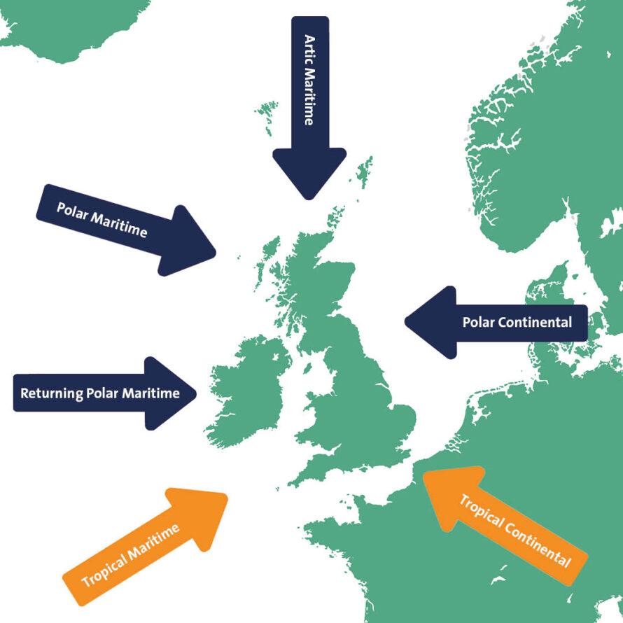
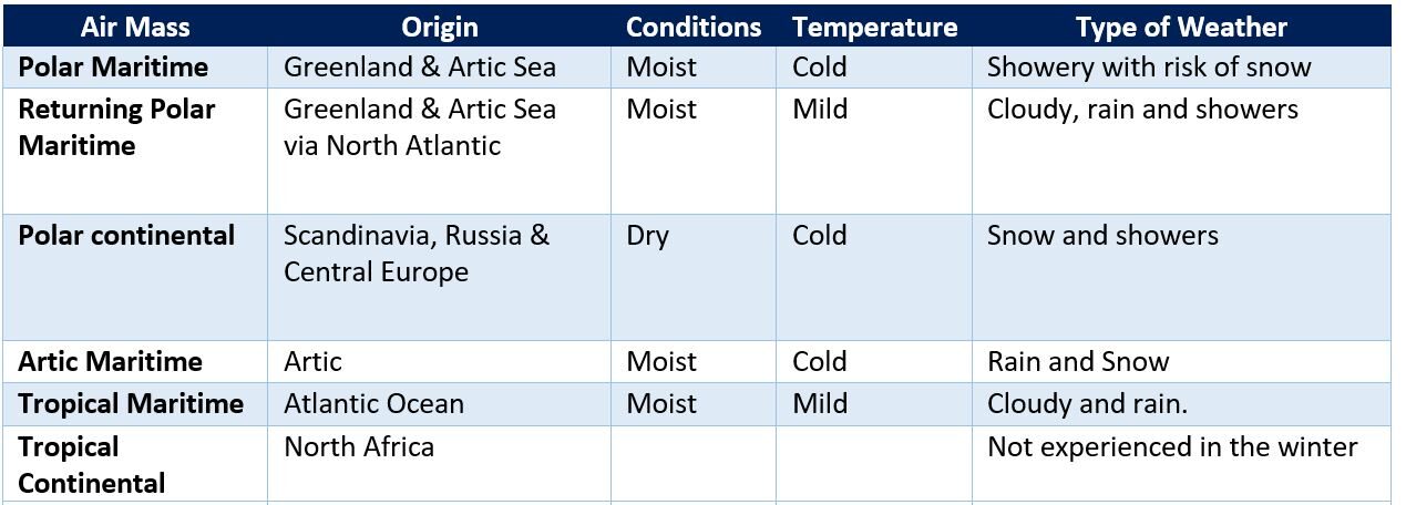
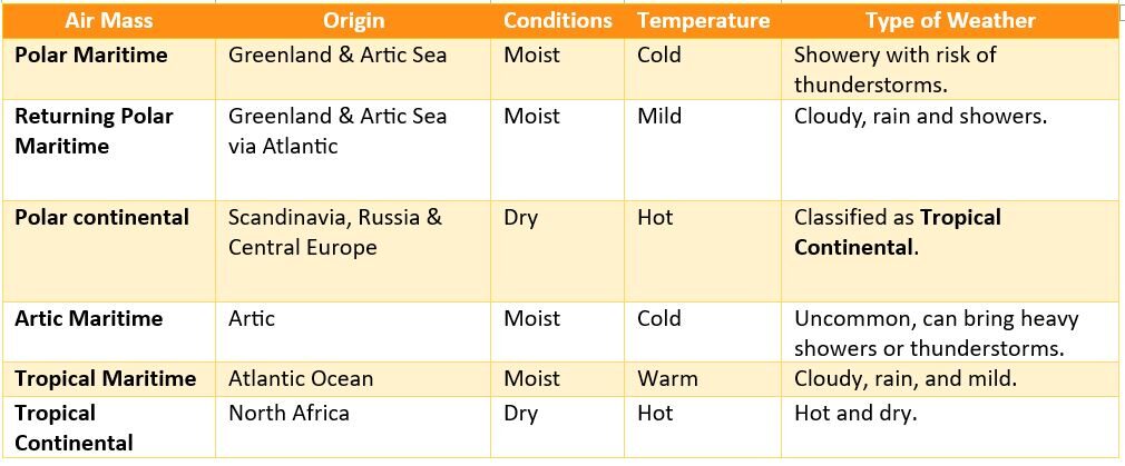
Volumes of air, called Air Masses, influence the UK’s weather. They are categorised by the location that they originated. Air Masses from over land are dry (continental) and over a body of water they are moist (maritime). Air from the north is cold (polar or artic) and from the south, warm (tropical).
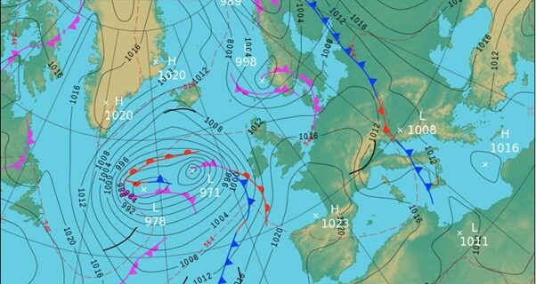
Fronts separate colder and warmer air when two air masses meet. A low-pressure system develops when the air becomes unstable, from warm air rising over denser colder air, and then cooling. Our frontal systems in the UK are a separation between polar and tropical maritime air masses.
During the winter, when maritime air masses arrive in the UK we expect milder temperatures, increased rainfall, and icy conditions due to freezing rain. With continental air masses we expect colder temperatures and increased potential for snow and icy conditions.
Polar Maritime – Our most common air mass, brought by westerly and north westerly winds from Greenland and the Artic Sea. As the cold air moves over a warmer sea, convection occurs, resulting in cloudy, cold, and showery weather when it arrives in the UK. In the winter we experience cold temperatures, rain and increased risk of snow and ice formation. Strong winds can also lead to snowdrifts.
Returning Polar Maritime – Although also originating from Greenland and the Artic Sea, this air mass is milder as it arrives in the UK via the North Atlantic. It brings cloudy conditions and showers.
Polar Continental – Northeasterly winds bring very cold air from Scandinavia, Russia, or Central Europe over a warmer sea. We experience this in the winter between November and April. During this time temperatures are extremely cold and below average. Showers and dry snow occur in the east and south. In the Summer, this air mass becomes
Tropical Continental, as the air is warmer and passes over a cooler sea, bringing drier conditions and above average temperatures.